- Profile Jurisdictions GOV DEPARTMENTS Cultures Travelling Educate
-
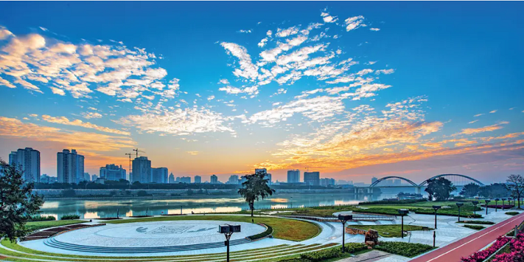
Nanning, located in Southwest China, facing the Beibu Gulf, is the capital and the political, economic, cultural, educational, technological and financial center of Guangxi Zhuang Autonomous Region. It is also a channel and frontier of China-ASEAN opening up and cooperation. Enjoying the reputations of the “Green City of China” and the “Folk Song Hub in the World”, Nanning is awarded the titles of the National Civilized City, the National Sanitary City, the Top Tourist City of China, etc.

History
In history, Nanning was inhabited by Baiyue people. In the first year of Daxing period of the Eastern Jin Dynasty (318 AD), Jinxing Prefecture was established here and Jinxing (now Nanning) became the seat of the Prefecture Government, ushering in the history of 1,700 years of Nanning’s organizational system. In the sixth year of Zhenguan period of the Tang Dynasty (632 AD), it was renamed Yongzhou and established as the seat of Yongzhou Commandery, because of which Nanning was referred to as “Yong”. In the first year of Taiding period of the Yuan Dynasty (1324 AD), Yongzhou Road was renamed Nanning Road, meaning tranquility of the borderland of South China, and as a result, the name “Nanning” came into being. On December 4, 1949, Nanning was liberated. On February 8, 1950, Nanning was confirmed as the capital of Guangxi. In March 1958, Guangxi Zhuang Autonomous Region was established and Nanning became its capital.
Locational Advantages
Nanning is blessed with unique geographical advantages. Located in the central south of Guangxi Zhuang Autonomous Region and backed by Southwest China, it adjoins Guangdong, Hong Kong and Macao to the east, and the Beibu Gulf to the south, and faces Southeast Asia. It is an important node along the “Belt and Road”, and where the South China economic circle, the Southwest China economic circle and the China-ASEAN economic circle converge. Situated close to the sea and Chinese border and along rivers and lines of transportation, it is the closest capital city to ASEAN countries. After the completion of the construction of Pinglu Canal, it will connect Nanning to the sea and reshape Nanning’s urban form and industrial ecology.

Administrative Divisions
With a total area of 22,100 square kilometers, Nanning is divided into 7 urban districts, including Xingning District, Jiangnan District, Qingxiu District, Xixiangtang District, Yongning District, Liangqing District and Wuming District, 5 counties (county-level cities), including Hengzhou City, Binyang County, Shanglin County, Mashan County and Long’an County, and three national development zones, including Nanning New & High-tech Industrial Development Zone, National Nanning Economic and Technological Development Area and Guangxi-ASEAN Economic and Technological Development Zone.
Natural Climate
Nanning is located in the south of the Tropic of Cancer with an average altitude of 76.5 meters. It has a typical subtropical monsoon climate featuring adequate sunshine, abundant precipitation, long summer and short winter, thus enjoying the mild climate. The mean annual temperature of Nanning is 21.8℃, the mean annual rainfall is 1453.4 mm, and the average annual sunshine duration is 1480.4 hours.
Population and Ethnic Groups
As a capital city, Nanning is home to Zhuang, Han, Yao, Miao, Dong and other ethnic groups. By the end of 2023, the permanent population of Nanning had reached 8,940,800.
Ecologically Habitable
In the past five years, the excellent air quality rate of Nanning has remained stable at over 94%, and the ambient air quality has reached the standard for seven consecutive years. “Nanning Blue” has become the name card of the city. Nanning has been selected into the first batch of “National Ecological Garden Cities” and the first batch of outstanding pilot cities for sponge city construction successively. The Green City, Nanning, boasts beautiful natural scenery and abundant cultural and tourism resources, with 98 national AAA or above tourist attractions including Qingxiu Mountain Scenic Area and Daming Mountain Scenic Area. Every corner in the city presents the ecological beauty of harmonious coexistence between human and nature.
Industrial Development
Nanning has made major efforts to optimize traditional industries, strengthen leading industries, and expand emerging industries, promoting the integrated development of cross-border industrial chains, supply chains and value chains, and sparing no effort to build key industrial clusters for new energy, new energy vehicles and components, electronic information, new chemical materials, and aluminum deep processing. It implemented the green manufacturing project in depth, accelerated the construction of a green manufacturing system, and added new impetus to industrial upgrading. Modern finance, regional headquarters economy, modern logistics, e-commerce, digital economy and other industries are developing rapidly, and the service industry is growing into a high-end industry. Nanning has also vigorously promoted rural revitalization and modernization of agriculture and rural areas, and accelerated the transformation and upgrading of traditional agriculture to famous, special, excellent, innovative and diversified agriculture. The scale of industries including the orange, jasmine and dragon fruit industries ranks first in the country. And the brand of "Yong (Nanning)" becomes even more influential.
Transportation
Maximize the potential of the “sea”. The Pinglu Canal is the backbone project of the New Western Land-Sea Corridor. Starting from the Pingtang River estuary in Xijin Reservoir Area of Hengzhou City, it passes through Luwu Town of Lingshan County in Qinzhou City and enters the Beibu Gulf along the Qinjiang River. The total length is about 135 kilometers, and the waterway is classified as a Class I inland waterway. After completion, it will become the shortest, most economical, and most convenient passage connecting the sea in Southwest China.
Stimulate the vitality of the “rivers”. The city will rely on the Pearl River-Xijiang River Economic Belt, and constantly upgrade waterway transportation. A number of major water transport projects have been built, including Laokou Shipping Hub, Yongning Water Conservancy Hub and the Class II Waterway from Nanning to Guigang.
Play the role of Nanning's closeness to Chinese border. Building major channels, connecting main hubs, and weaving a dense network, so as to accelerate the construction of regional international logistics hubs, and improve the level of an open economy.
At present, Nanning Metro Line 1, Line 2, Line 3, Line 4 and Line 5 are in service, forming a new pattern of transport network that “crosses rivers and runs through the whole city”.
“Nanning Channel”
Nanning closely centers on the new positioning and mission of building an international metropolis open to ASEAN cooperation and a China-ASEAN cross-border industrial integration and development cooperation zone, fully, accurately, and comprehensively implementing the new development concept, actively integrating into and serving the new development pattern, vigorously opening up channels, and continuously creating new growth points for an open economy. Nanning, committed to promoting the upgrading and development of China-ASEAN Expo and China-ASEAN Business and Investment Summit with high-quality service, has given full play to the advantages of a series of national opening-up strategies and continuously strengthened the opening-up platform, establishing the “Nanning Channel” for economic and trade cooperation, exchanges, communication, meetings and consultations between China and ASEAN countries. At present, 6 ASEAN countries have set up consulates general in Nanning, and 27 cities have set up international sister city relationships with Nanning.
contact details
Tel:00-86-0771-5532698
Address:No.1, Guinbin Road, Qingxiu District, Nanning City, Guangxi Zhuang Autonomous Region, China
Working hours:Monday to Friday, except official holidays: 8:00 a.m. - 12:00 p.m.; 15:00 p.m. - 18:00 p.m;

